 Image source, Getty
Extreme heat warnings were issued across England and Wales last week
BySimon King
Lead Weather Presenter
Temperatures have fallen from the record-breaking highs seen across the UK last week - but there are signs another heatwave could be building as July begins.
Some forecasts suggest temperatures could climb back up into the the mid-30Cs in England and Wales next week. While the Met Office has described the weather as "warmer-than-average", there is still uncertainty about how hot conditions might get.
"Although a return to heatwave conditions is looking increasingly likely for some areas, the likelihood of such extreme high temperatures or high levels of humidity as last week is currently low", deputy chief forecaster Tony Wisson said.
A new provisional UK heat record for June of 37.7C (99.9F) was set in Lingwood, Norfolk, on Friday.
This beat the previous June record of 35.6C recorded in 1957 and equalled in 1976.
National temperature records also fell in at least eight European countries in the last week, with red extreme heat warnings remaining in force across eastern Europe.
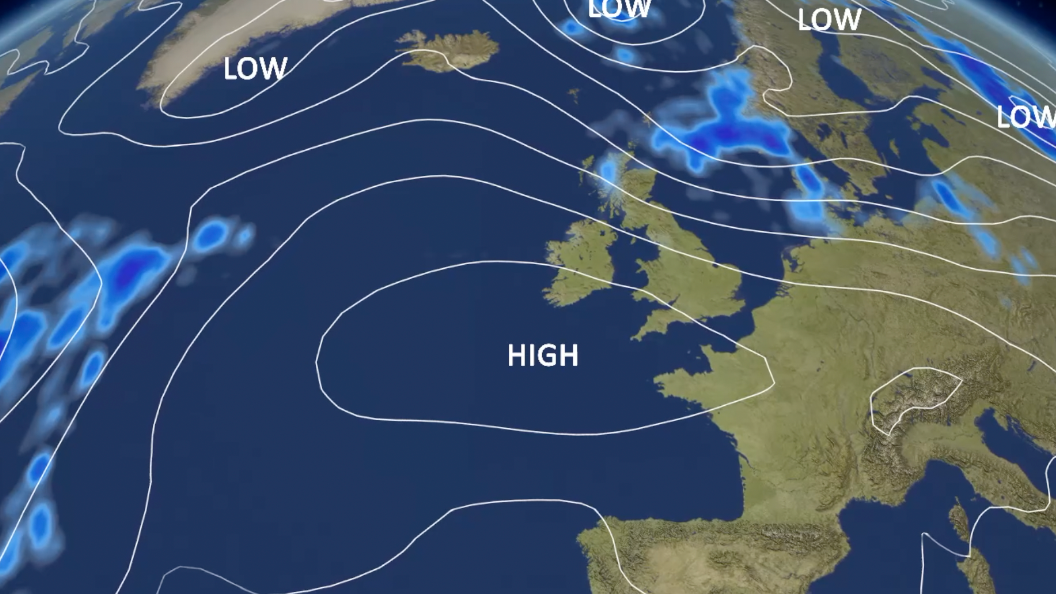
High pressure will start to move in from the south-west later this week, which will in turn start to bring warmer weather again
We are now heading into July and for the UK, the hottest month of summer in terms of average maximum temperature.
Forecasters from the Met Office and BBC Weather's data supplier released their summer outlook on 1 June and suggested that there is "an increased chance of heatwaves and heat-related impacts".
The "above-average temperatures" are expected in July and August with "significant bursts" of heat in the UK, and across Europe.
High pressure will gradually move in from the south-west across western Europe and into England and Wales by the end of this week.
Temperatures could then rise into the mid to high 20s across the Midlands, eastern and south-east England. And into next week, temperatures could rise more widely across England and Wales and enter into an official heatwave.
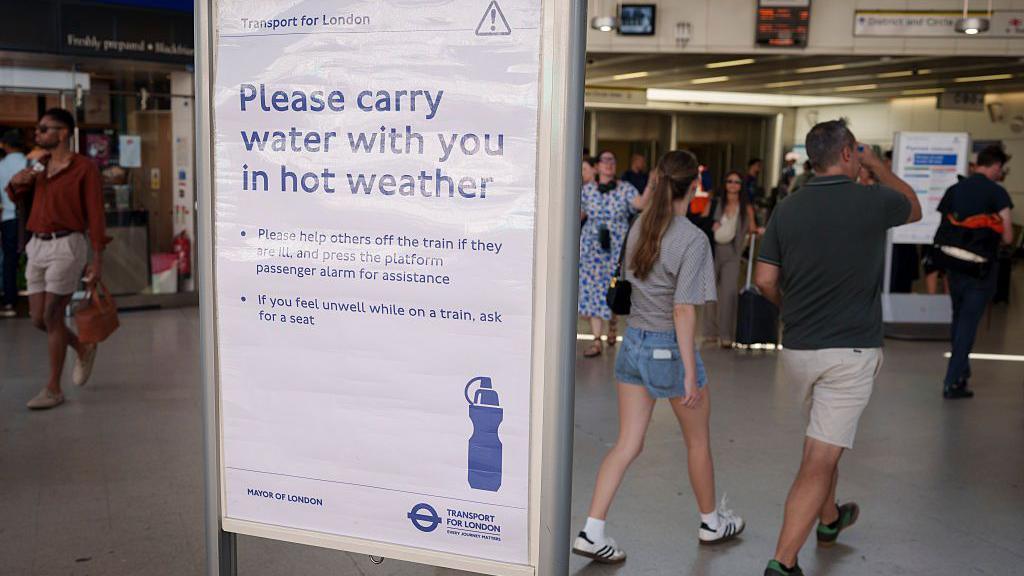 Image source, Getty
It is still too early to say how hot it might get and whether we'll get more extreme heat warnings and impacts seen during the record heatwave last week
Forecasters use different weather models which can give a range of forecast temperatures. And this is updated around twice a day.
This in turn gives us an idea of the uncertainties and likelihood of any specific forecast temperature rather than relying on one particular outcome.
The Czech Republic, Germany, Poland and Denmark all recorded their hottest days on record in the last week.
More than 1,300 excess deaths since 21 June have been linked to the heatwave, according to the World Health Organization. Of those, around 1,000 were in France where hundreds of local June and all-time records were broken.
The number of deaths is likely to increase once all the data and reports from all European countries have been collated.
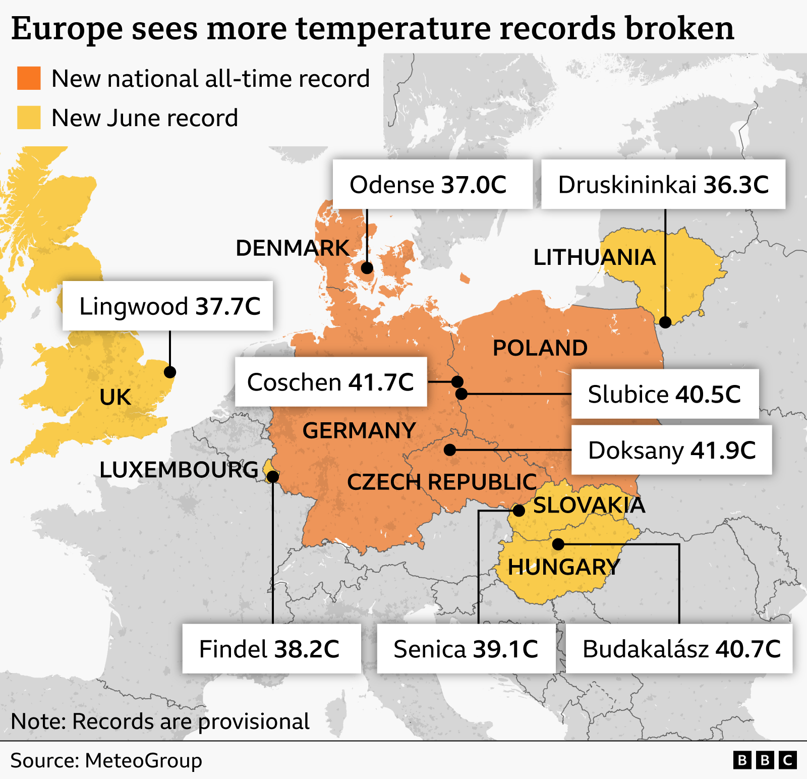
National all-time and June records have been broken right across Europe over the last week
The large area of high pressure which brought the intense heatwave - also known as a "heat dome" - has shifted further east across Europe.
Red extreme heat warnings remain across Poland, Slovakia, Romania, Serbia and Croatia where temperatures are expected to be in the high 30s Celsius.
Widely temperatures will be around 8 to 12C above average for the end of June.
Across western Europe and the UK, while temperatures are still likely to be higher than average this week for some, we will not see the extremes of last week.
And gradually, those in eastern Europe will get some relief as temperatures gradually drop through the week ahead.
Keep up to date with the latest forecast where you are.